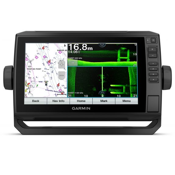
Garmin ECHOMAP UHD 92sv without transducer (adapter cable 8-pin included)
Garmin ECHOMAP UHD 92sv without transducer (adapter cable 8-pin included)
753759241612
010-02341-00
Description
Physical activity and performance
Physical dimensions: 28.2 x 16.4 x 6.0 cm
Water rating: IPX7
Mounting options: Bail or flush
Antenna: Internal or external via NMEA 2000
Receiver: 5 Hz
Display size, W x H: 19.9 x 11.3 cm; 22.9 cm (9.0") diagonal
Display resolution, W x H: 400 x 800 pixels
Weight: 1.0 kg
Display type: WVGA display
Maps and navigation
Accepts data cards: 1 microSD™ card, 32 GB maximum size
Track log: 50,000 points; 50 saved tracks
Preloaded maps: Worldwide basemap
Routes: 100
Features
Maximum depth: 700 meters at 77 kHz, in freshwater; 335 meters at 77 kHz, saltwater (depth capacity depends on water bottom type and other water conditions)
Wireless remote compatible: No
J1939 Compatible: No
Dual-frequency sonar capability: Yes
Transmit power: 500 W (RMS)/4,000 W (peak-to-peak)
Compatible with XM WX weather and radio for USA and Canada: No
Polarized Support: No
Water temperature log and graph: Yes
FUSION-Link™ compatible: No
Power consumption: 18 W
NMEA 0183 output ports: 1
NMEA 2000® compatible: Yes
Bottom lock (shows return from the bottom and upward): Yes
Garmin ECHOMAP UHD 92sv without transducer (adapter cable 8-pin included)
1386270Garmin
Out of stock
RRP: 1,077.40 €Price:1,045.08 €
Physical activity and performance
Physical dimensions: 28.2 x 16.4 x 6.0 cm
Water rating: IPX7
Mounting options: Bail or flush
Antenna: Internal or external via NMEA 2000
Receiver: 5 Hz
Display size, W x H: 19.9 x 11.3 cm; 22.9 cm (9.0") diagonal
Display resolution, W x H: 400 x 800 pixels
Weight: 1.0 kg
Display type: WVGA display
Maps and navigation
Accepts data cards: 1 microSD™ card, 32 GB maximum size
Track log: 50,000 points; 50 saved tracks
Preloaded maps: Worldwide basemap
Routes: 100
Features
Maximum depth: 700 meters at 77 kHz, in freshwater; 335 meters at 77 kHz, saltwater (depth capacity depends on water bottom type and other water conditions)
Wireless remote compatible: No
J1939 Compatible: No
Dual-frequency sonar capability: Yes
Transmit power: 500 W (RMS)/4,000 W (peak-to-peak)
Compatible with XM WX weather and radio for USA and Canada: No
Polarized Support: No
Water temperature log and graph: Yes
FUSION-Link™ compatible: No
Power consumption: 18 W
NMEA 0183 output ports: 1
NMEA 2000® compatible: Yes
Bottom lock (shows return from the bottom and upward): Yes
Refers to which product family the product belongs to. In many cases, there are matching reels and rods within the same product family. These items are designed to work together.